The Most Famous Sahyadri Locations: Advanced Topography and Technical Mechanics of the Western Ghats
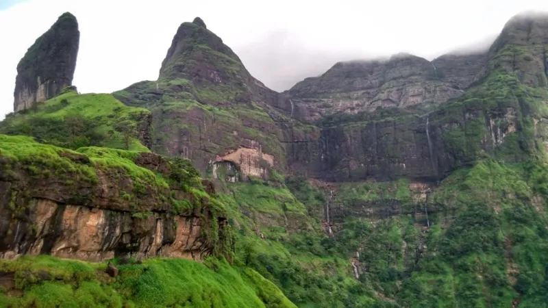
The 1,600 km Sahyadri mountain range runs parallel to the Indian west coast, spanning over six Indian states: Maharashtra, Goa, Gujarat, Tamil Nadu, Karnataka, and Kerala. It has been called the UNESCO World Heritage Site, owing to the amazing biodiversity and cascading waterfalls from the high ranges. The beautiful Sahyadri locations are unlike the traditional folded mountain ranges.
Did you know that Sahyadri was formed around 65 million years ago by the continuous rifting and drifting of the Indian subcontinent? For the same reason and the fact that this range is located at a faulted, raised edge of the Deccan Plateau, the technical mechanics of the Sahyadri always gain traction from the crowd.
So, which of the common locations are worth visiting, and how does it make for some of the best adventures of your life?
Nalichi Vaat vs. Sadhleghat: A Technical Blueprint for Scaling Harishchandragad’s Hardest Routes
Close to Mumbai is the Harishchandragad Fort, a location with its history engraved in the 6th century during the Kalchuri dynasty. It is located at an altitude of 4,670 ft above sea level and is accessible via two prominent routes: Nalichi Vaat and Sadhleghat.
Nalichi Vaat
From Belpada, your trek towards Harishchandragad starts via Nalichi Vaat. Often known as the “passage through the gorge”, the Nalichi Vaat is on the extreme right side and at an 80-degree placement. It is advisable for experienced and active individuals who feel no pain travelling through the rocky trails. But if you are at the beginning of your fitness journey, we advise you not to choose the route, as it can be exhausting and test your endurance.
Sadhleghat
Sadhleghat is still a challenging trek and involves a steep slope, but it is less exhausting than Nalichi Vaat. Begin this route by walking straight from Belpada to Kelewadi and not choose the Konkan Kada route. Once you reach Kelewadi Village, ascend through a steep slope that takes you to your location.
Sahyadri Scree Slope: Footwear Mechanics for the Moroshi Bhairavgad Rock Patch How to Do
Another popular location through the Sahyadri slope is the Moroshi Bhairavgad Rocky Path. But it isn’t just a steep slope you have to climb with your regular sports shoes. The terrain continuously changes as you walk through it. The gravelly scree and loose stones can sometimes make your balance a little shaky. In such situations, the footing becomes more important to look after than the speed. So, your best bet is to maintain controlled footsteps so there’s no slippage.
While covering this rocky path, your footwear plays an integral role. Worn-out or uncomfortable shoes can quickly cause blisters and make you lose control. So, the idea here should be choosing trekking shoes that maintain traction on all kinds of surfaces. Additional tip is keeping your body weight stable and maintaining a consistent pace. It will ease your trekking on difficult routes.
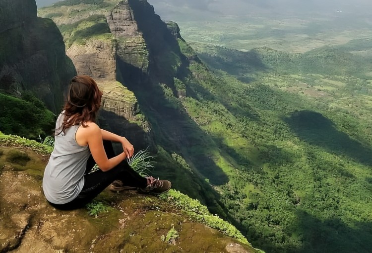
Managing Spatial Vertigo: The Psychological Blueprint for First-Time Climbers on Bhairavgad’s Open Pinnacle
The open pinnacle of Bhairavgad fort can sometimes be mentally exhausting for a lot of people, especially those who are doing it for the first time. This path does not have enclosed paths but rather exposed sections that can lead to some kind of discomfort or hesitation for the trekkers.
Imagine yourself crossing the paths and directly looking down at the valleys. It can play with your psychology and make the climb more intimidating than it actually is. So, it is extremely crucial that you maintain discipline and focus on your every movement instead of focusing on what’s beneath. Concentrate on your footsteps and keep up your confidence throughout the climb.
A lot of beginners may also feel nervousness about what’s going to happen. But when you focus on one step at a time, the nervousness steps aside and you become more comfortable. Yes, the Sahyadri’s Bhairavgad path may seem risky, but it is rewarding and offers peace which is not felt otherwise.
Devkund: How the Bhira Dam Catchment and Sudden Flash-Flooding Zones Actually Work
The Devkund route goes through the landscape that is surrounded by gushing water and the Bhira dam catchment area. When the monsoon arrives, the rainfall pours over the hills and streams, filling water into the connected channels. It means that the water level can significantly increase in some areas and may not even be visible through the trekking routes.
That’s one reason why the place can cause a flash-flooding zone, changing the entire trek trail. The small streams become more like a crossing, but the sections are still manageable. Yes, the rocky surface can be a little slippery because of the continuous water runoff, but with the right strategy in place, it becomes okay.
But there’s always caution to maintain among trekkers. They should not assume that if the starting point is okay, the entire route will be stable. The weather can quickly drift in the upcoming areas as the local rainfall increases. Once you understand the landscape responds dynamically to rainfall, trekkers can cover the Devkund route cautiously and safely.
Why you Should Visit These Treks in Monsoon and Their Difficulty Levels
After discussing the Sahyadri Ghat treks and the risks associated with them, trekkers might wonder, why should they even consider these routes? What they don’t realise is that during monsoon, the landscape looks more beautiful with misty cloud cover and blooming flowers. Yes, the trekking can be challenging, but if you are cautious, know how to take care of yourself, and follow the safety procedures, you can reach the destination comfortably. It is all about the right shoes and equipment in place.